Tag Archives: Nullabor

Aussie Lap – SA, Nullabor, Cliffs of Bight

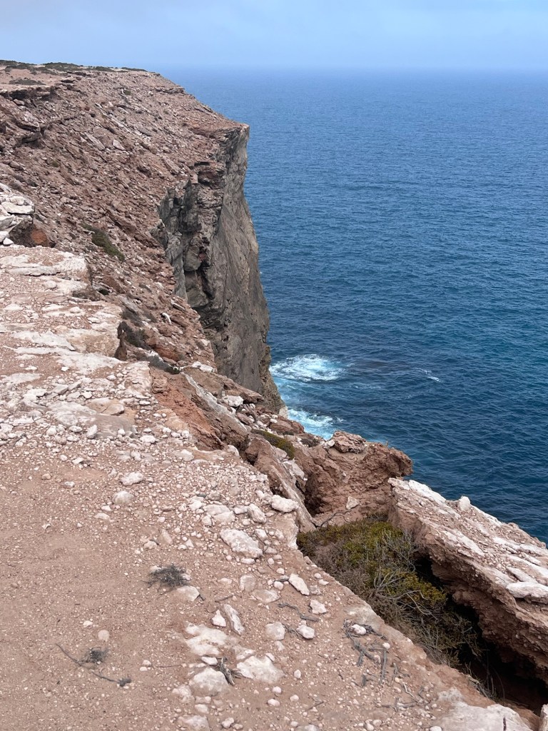
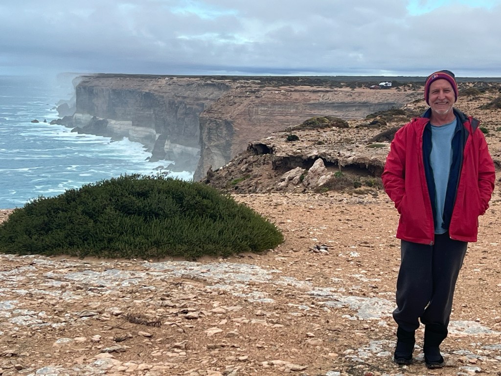
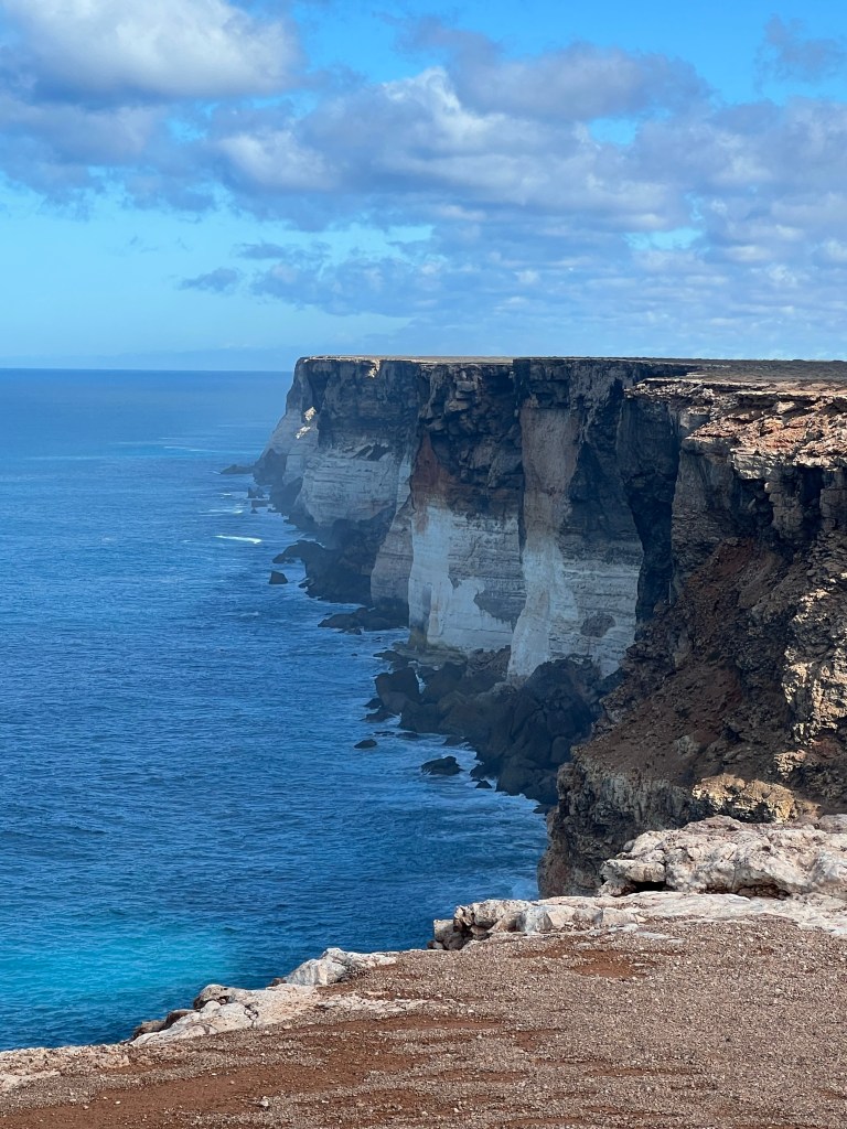
Locations: Nullarbor, Cliffs of Bight, Penong, Point Sinclair

Regions: Alinytjara-Wilurara

Dates: Sunday 18 – Thursday 22 February 2024

Temperatures: 15 – 31 degrees, fog and sun

Monday 19 February, 15 – 29 degrees.

The night was cool and Rob and I are grappling with the time change. Yesterday the time had kept switching back and forth; four times, after we left Eucla. Starting at 11:50am WA time which changed to 2:20pm SA time then back again a short time later and then switching back and forth several times.

We arrived at the Bunda Cliff Camp 2 at 3:00pm WA or was it 5:30pm SA time? We decided to stick with WA time for the rest of the day and then SA time from tomorrow.

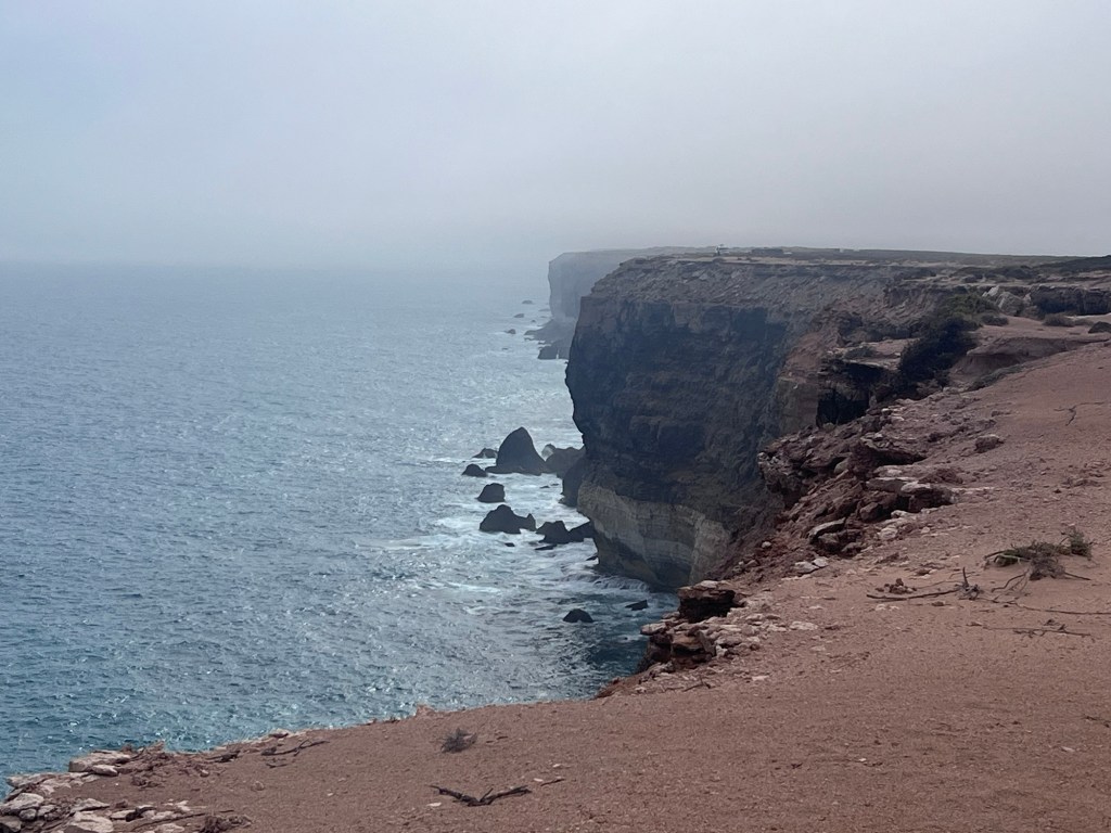
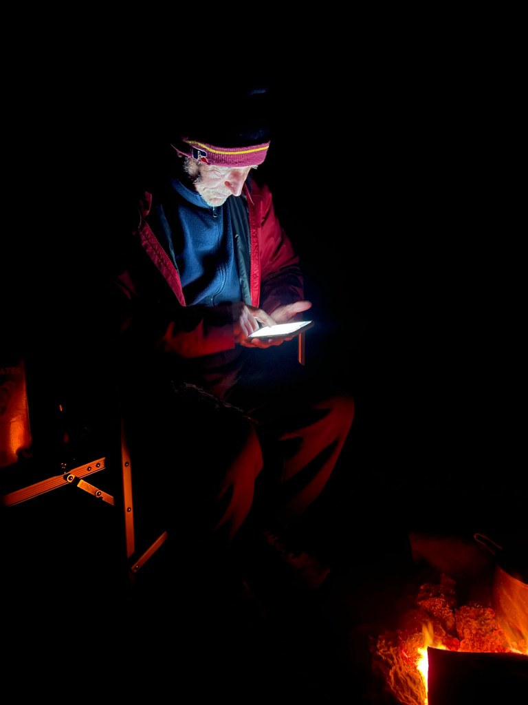
The night skies are amazing but I can’t get good photos with the iPhone… need to work on this!

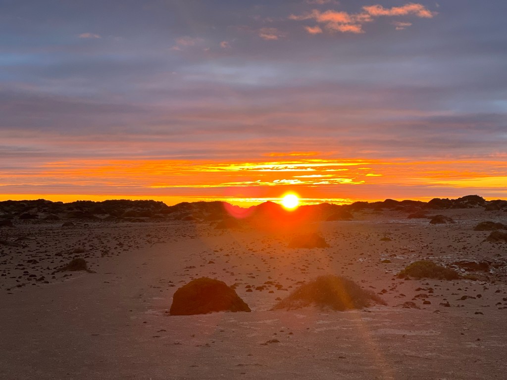
Monday morning we wake at 3:30am WA time, 6:00am SA time just as the sky lightens. There has been a very heavy dew overnight and it’s a cool 15 degrees.

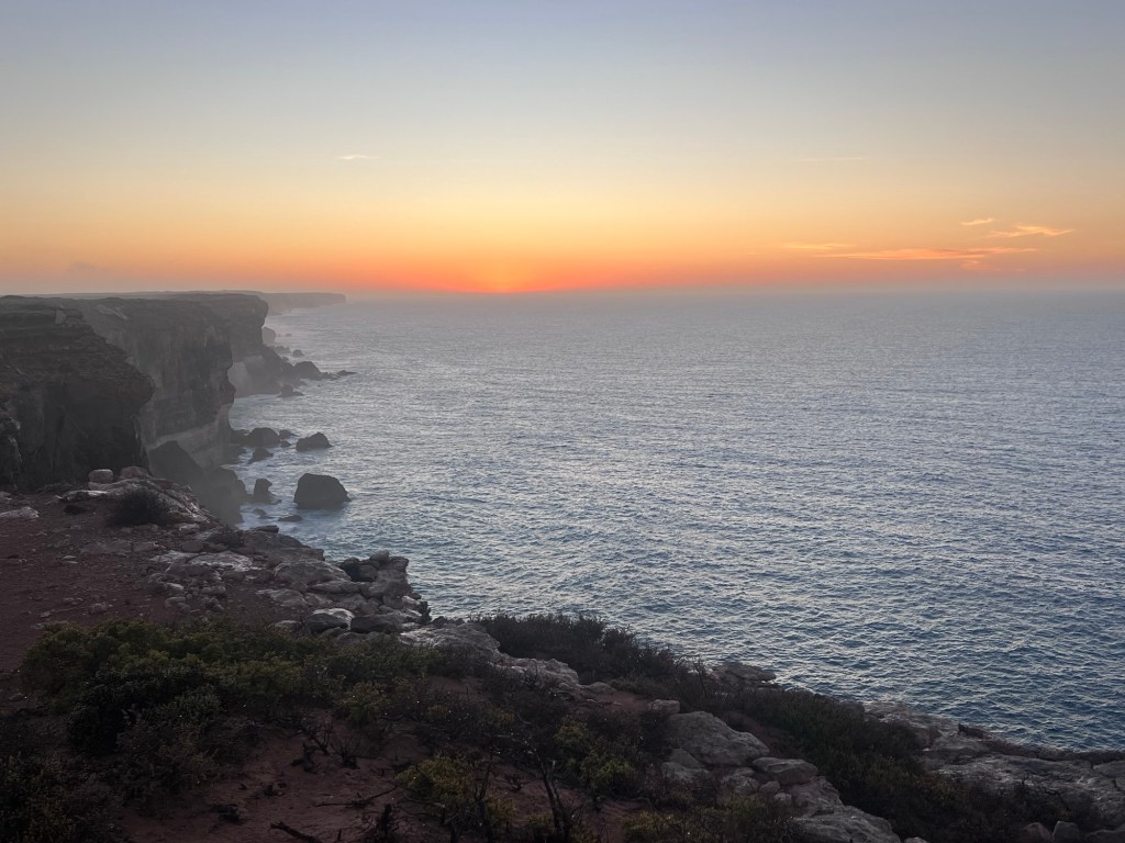
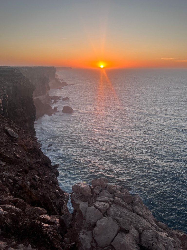
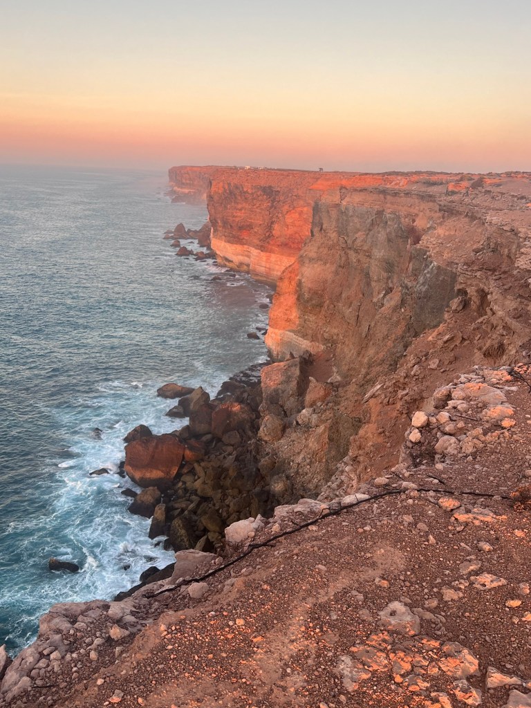
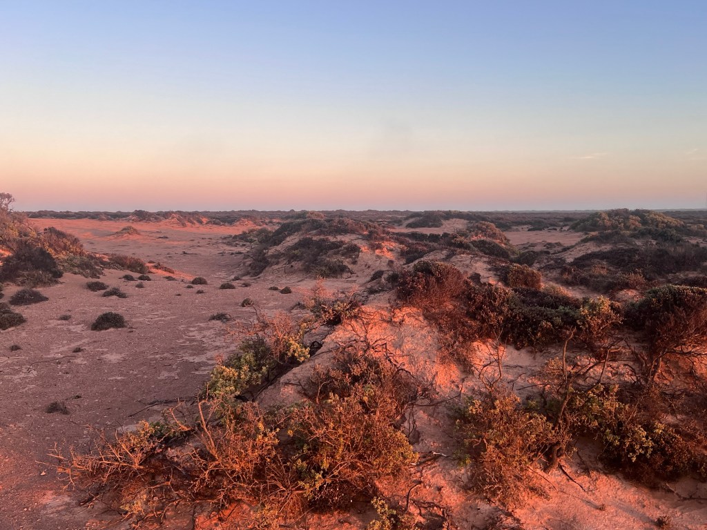
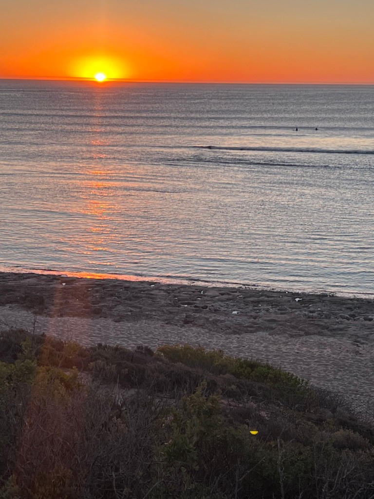
The sunrise is spectacularly beautiful.

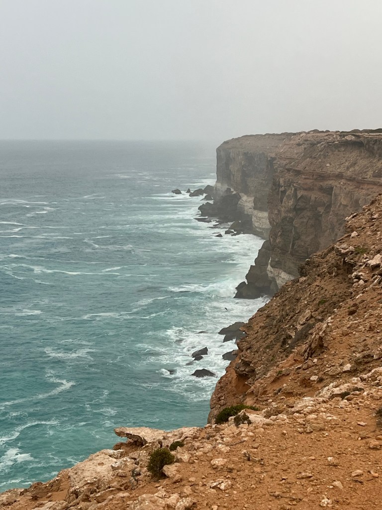
We anticipate a quiet day with a long walk but around 9:30 a fog rolls in… and continues until about 4:30pm and then starts to lift a little. We set up the Starlink and Rob relaxes with a movie – Oppenheimer and I catch up the blog and make some date scones. Yum!

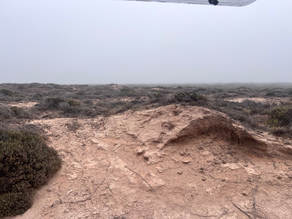
We head out for a long walk about 4:30pm but the mist continues, rolling in as it gets later in the day.

Tuesday 20 Feb, 18-31 degrees

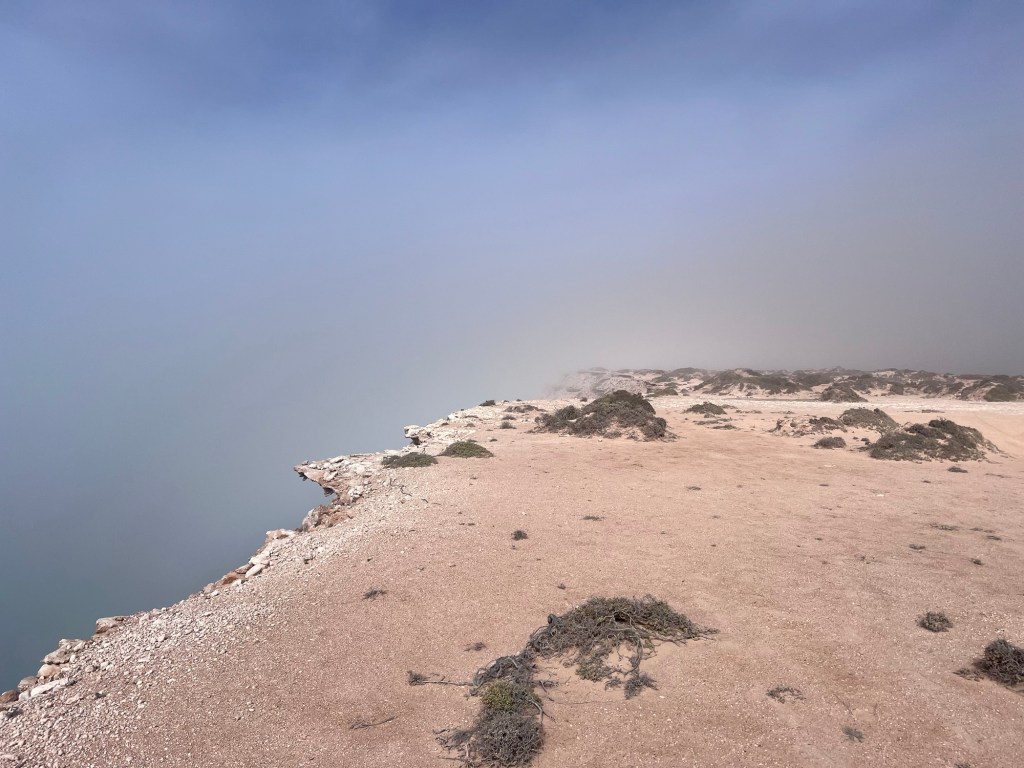
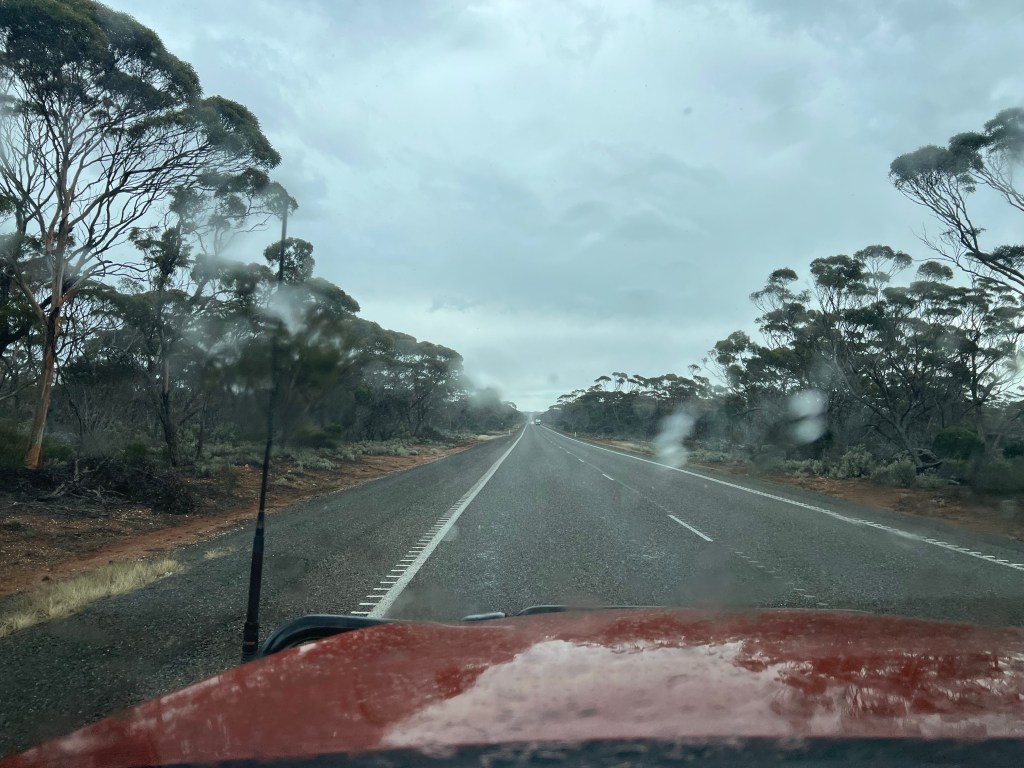
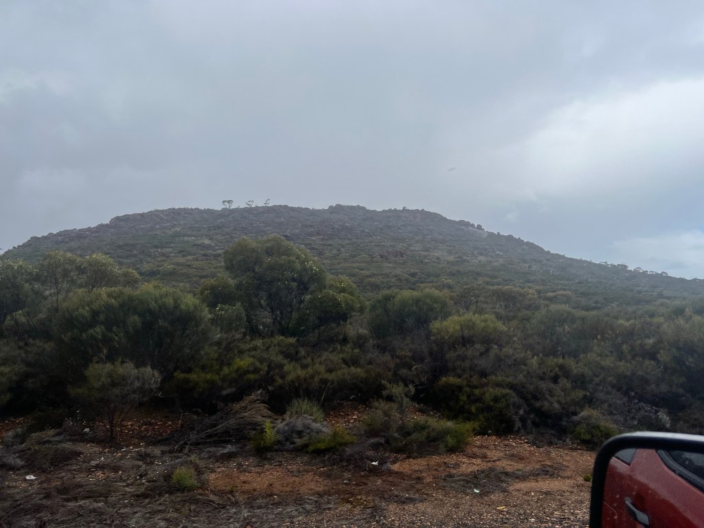
Tuesday dawned, still misty on the cliffs so we decided to cut our time here and move on. This is one of the main benefits of free camping – flexibility.

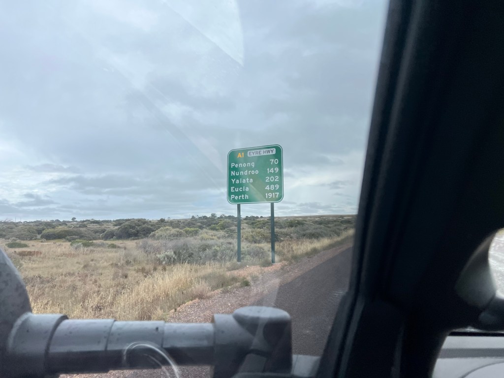
A couple we met from Mandurah, WA the previous day on the cliffs (sorry can’t recall their names!) recommended Cactus Bay, 270kms East and 20km South of Penong which is about 60km West of Ceduna on the WA/SA border so we thought we would check it out.

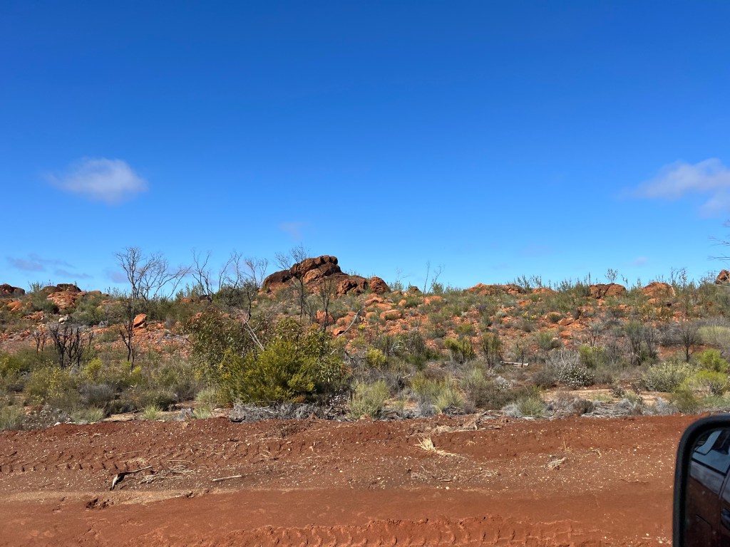
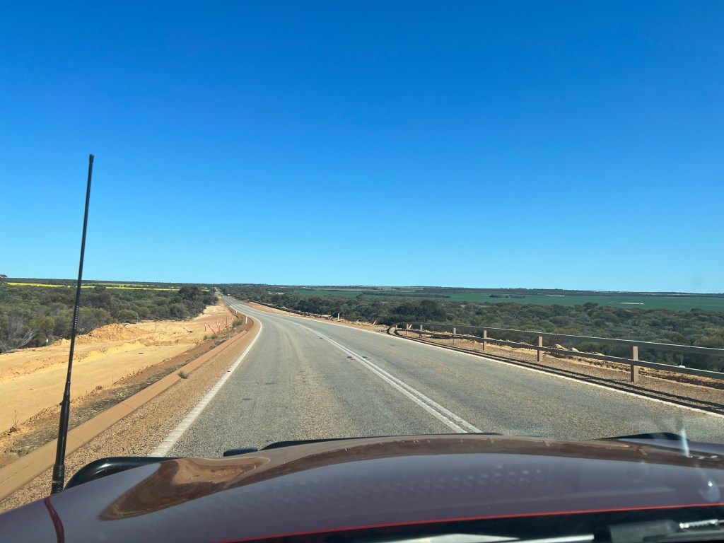
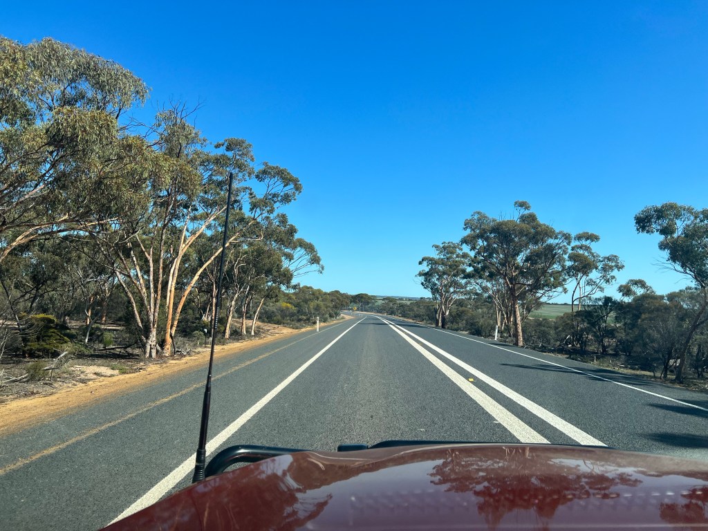
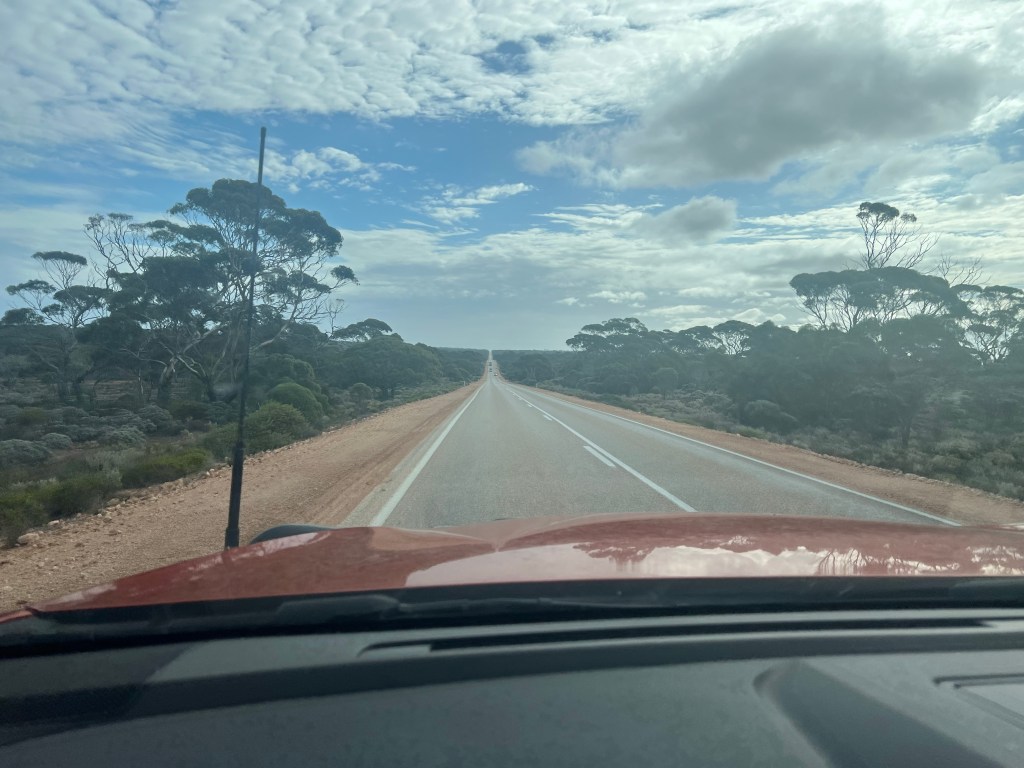
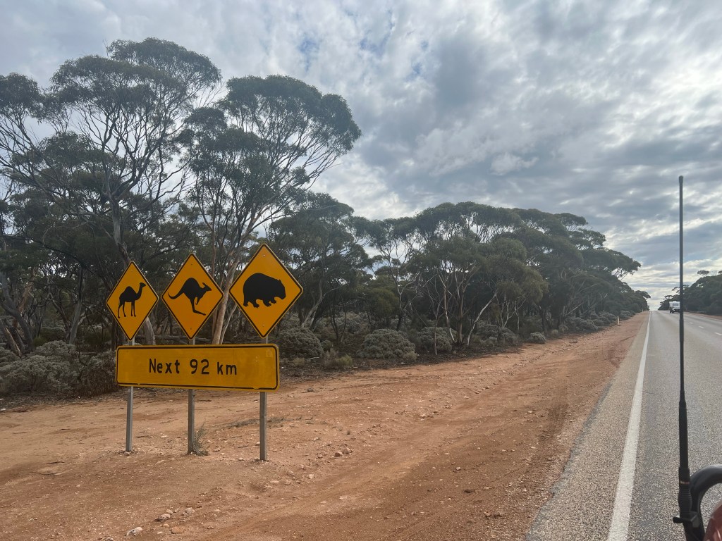
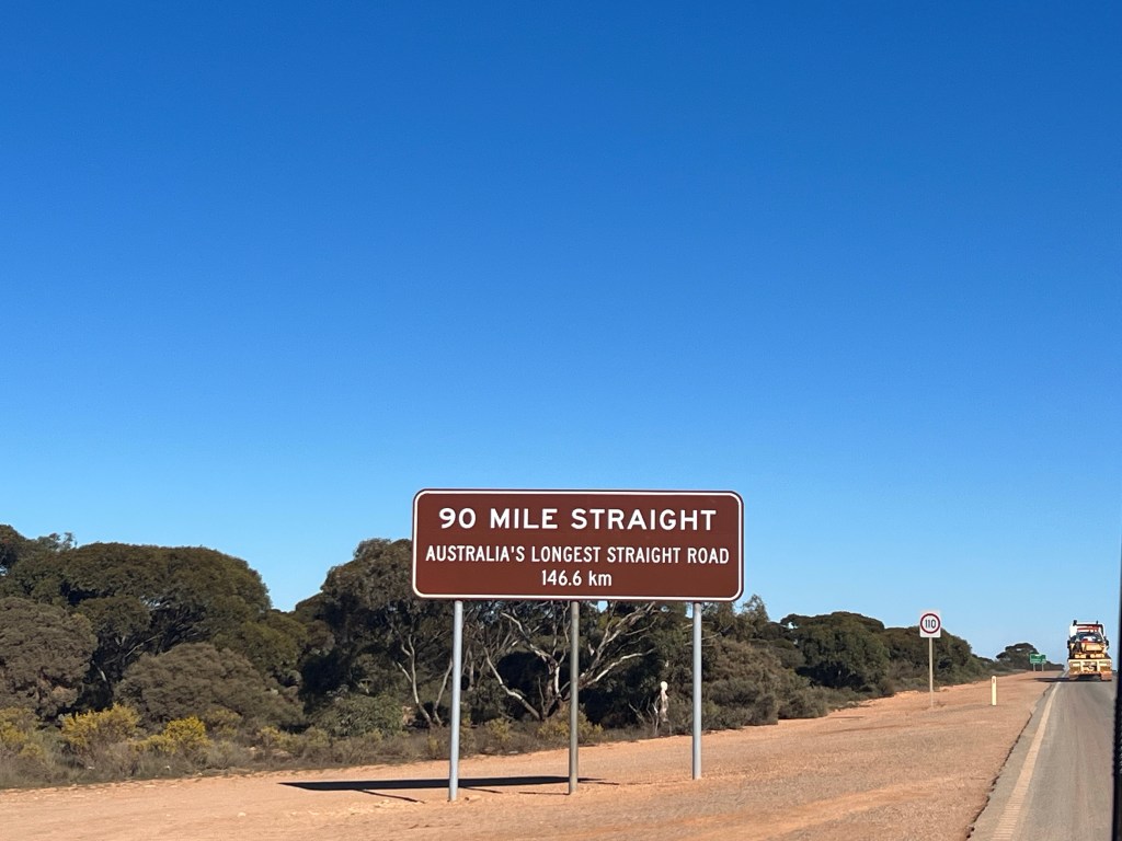
The journey is uneventful (always what we hope for 😀) with a few wide loads on trucks to navigate; 4.5metres wide the largest, and again the UHF is a must when travelling these roads, even if you aren’t towing.

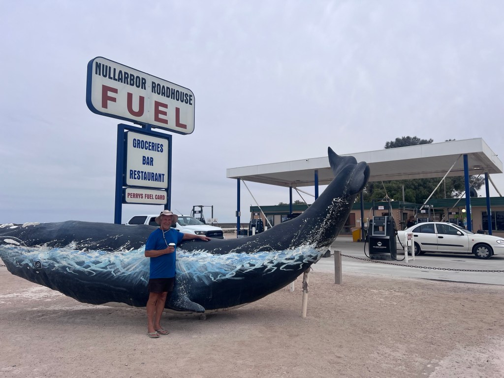
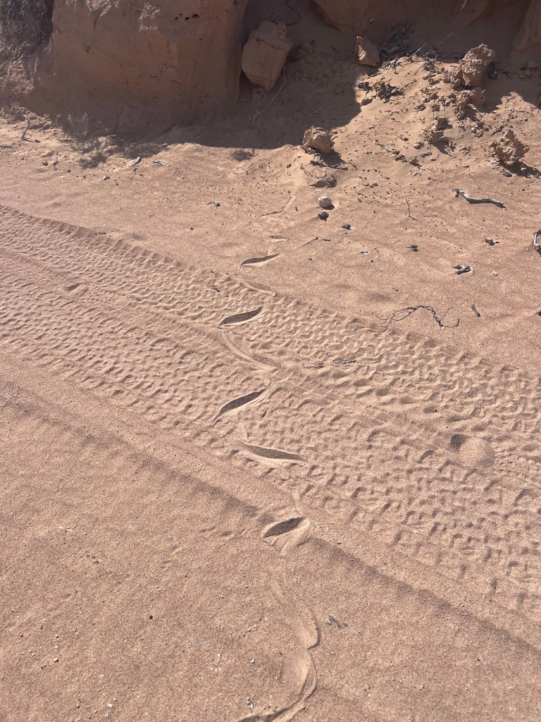
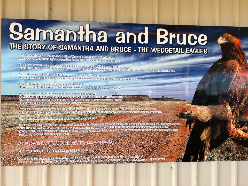
Crossing the Nullarbor the only animal we see is a dingo, very casually crossing the road as we approach Nullarbor Roadhouse but I miss getting a photo. We stop for a coffee and I find a very similar hat to the one Rob lost last week as a gift for him.

Love you handsome. ❤️

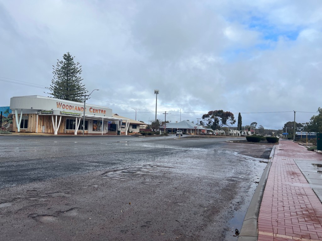
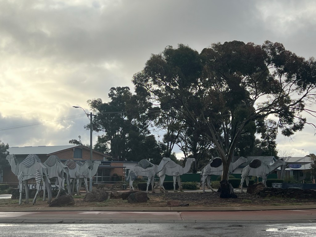
We stop at Penong for milk and greens to finish a roast beetroot and radish salad I have planned to go with steak for dinner and then turn South towards the Coast.

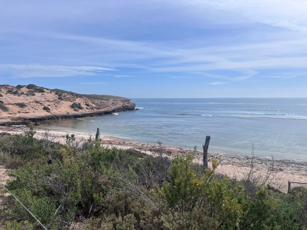
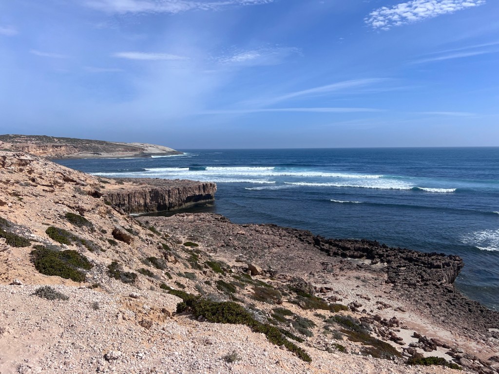
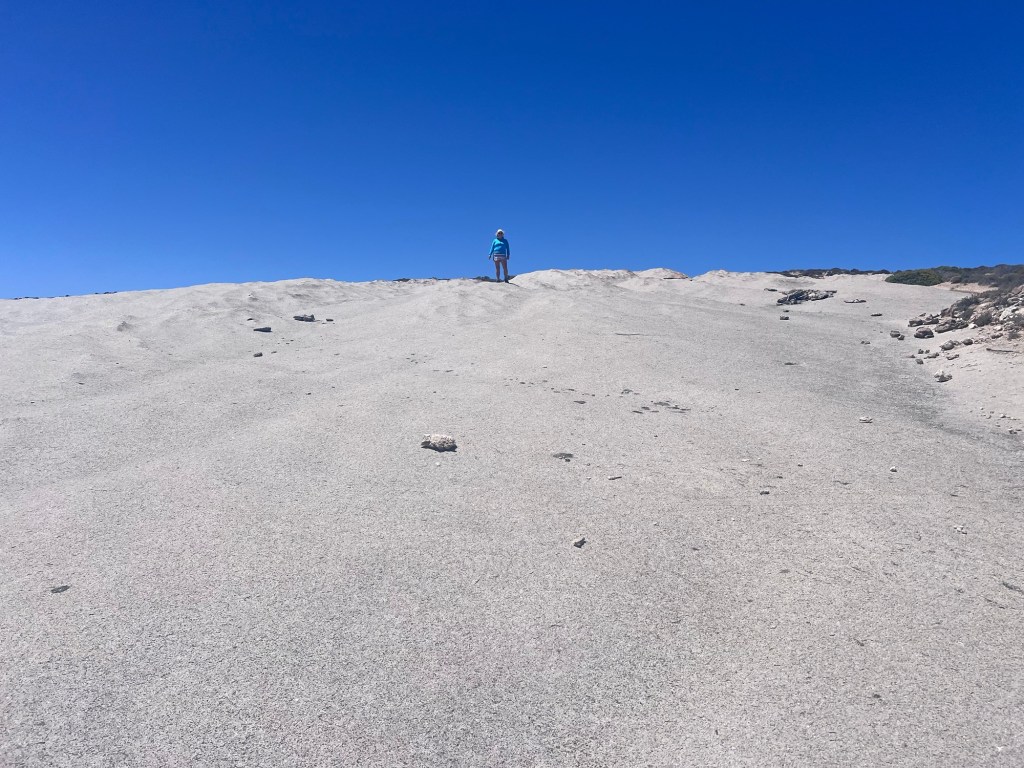
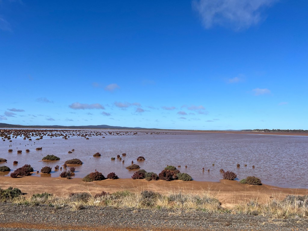
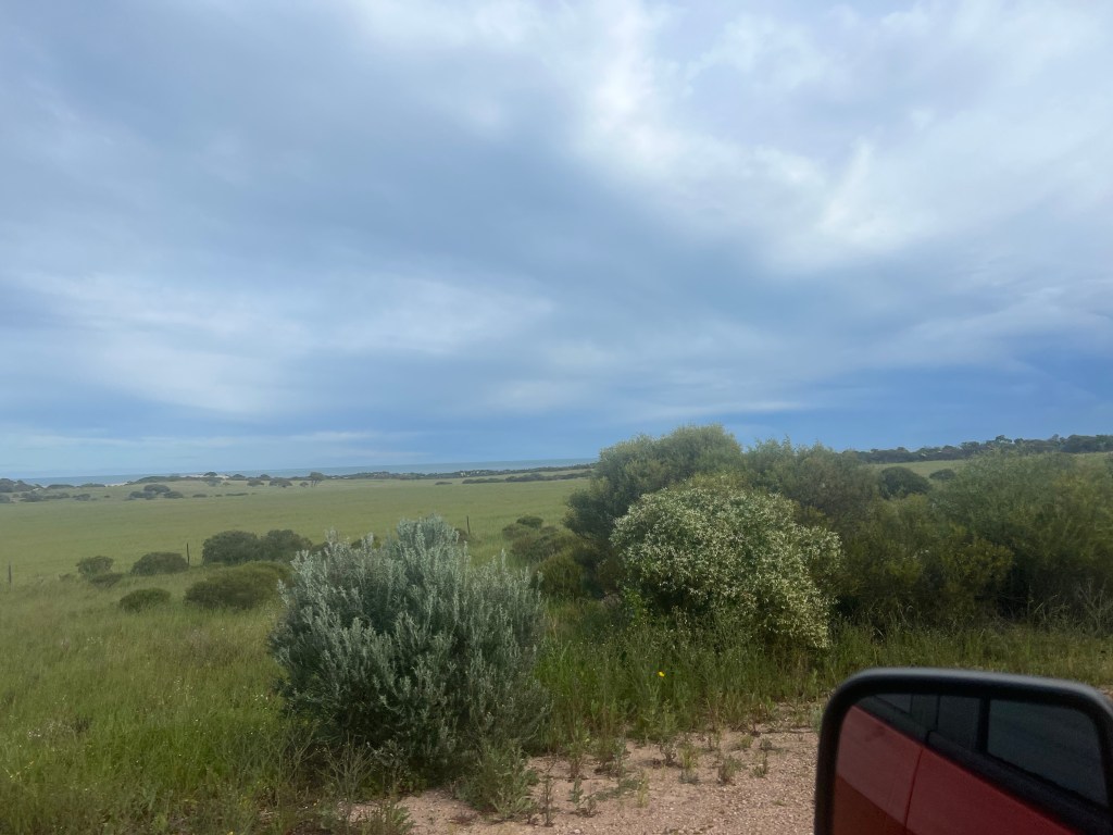
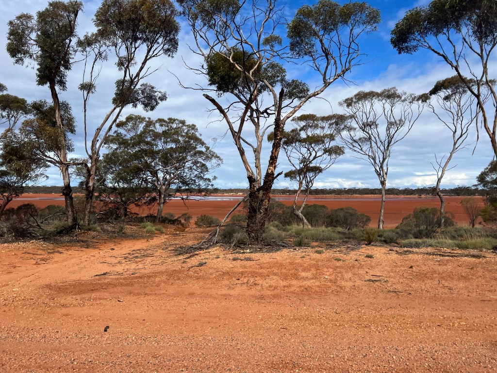
I’ve heard good things about this camp so I’m excited. The road out is tough with lots of corrugated ruts and holes so it’s a slow drive which is ok as there is lots to see. The pink lake at Point Sinclair may be pink in full sun, so maybe tomorrow, lake Mac Donnell stretches out on the left and towering sand dunes are both left and right.

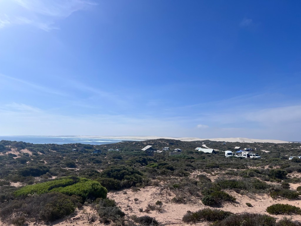
This is a private camp and first in, best served to find a camp spot. It looks reasonably full so we feel fortunate to find a nice, reasonably flat spot with a flushing toilet nearby! The facilities are amazing including many toilets, cold showers and a camp kitchen at a very reasonable day rate per person. Happy Days!

The surfers beach is a short walk over the dunes and the point is just up the road. After setup we take a walk to explore the area.

Wednesday 21 Feb, 17 – 27 degrees

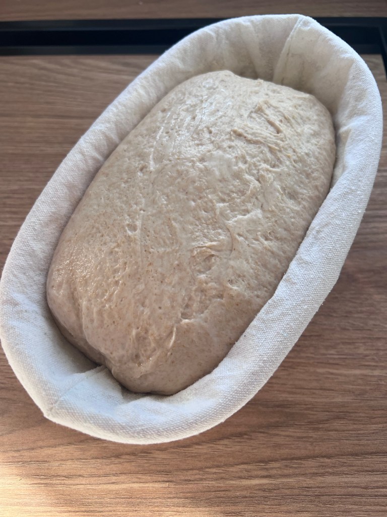
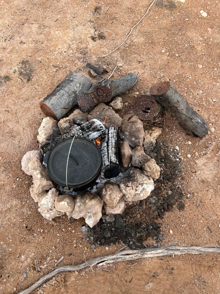
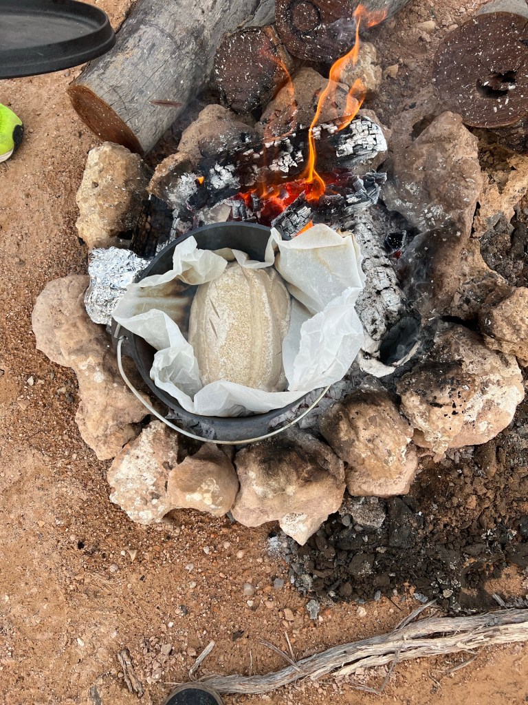
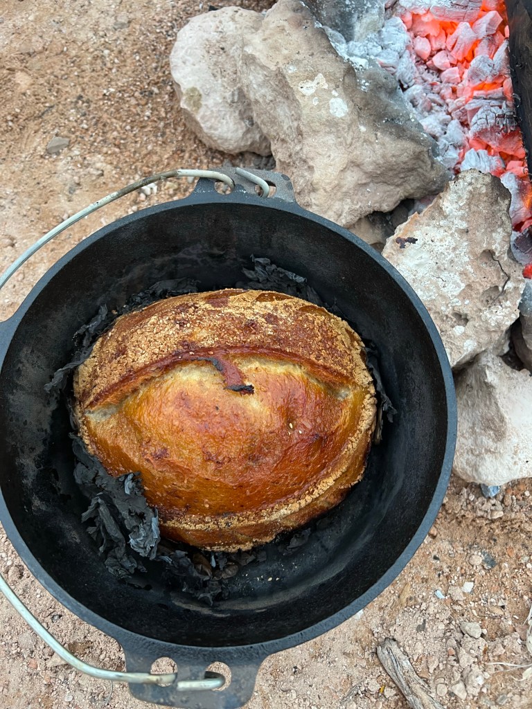
I start a sourdough for a loaf around 8:00am and after the folds set it aside for the 1st proof and Rob and set out for a cross country hike and a swim at Point Le Hunt.

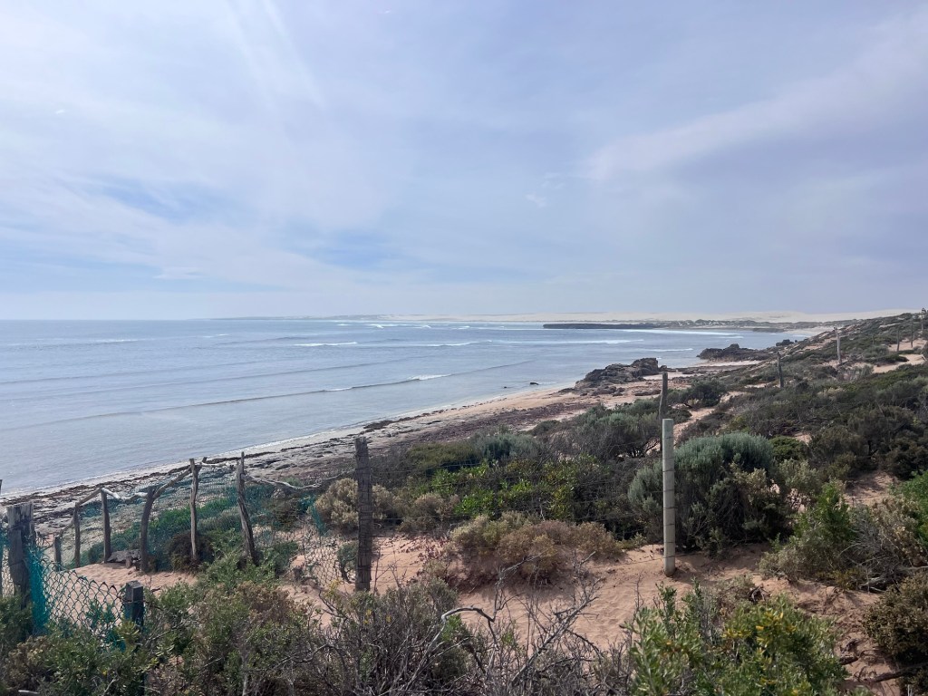
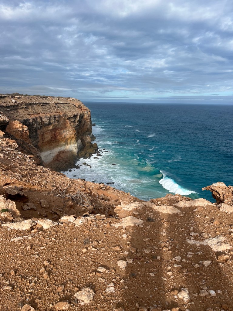
We start the walk on Cactus Beach and then head for the rough coastal path which follows the point around to the left.

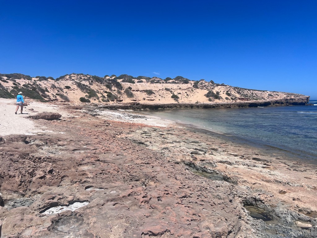
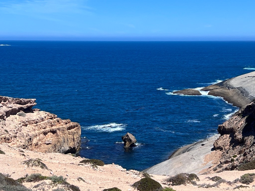
We follow the edge as long as possible but eventually need to go up and along the coastline before we come to a huge expanse of granite.

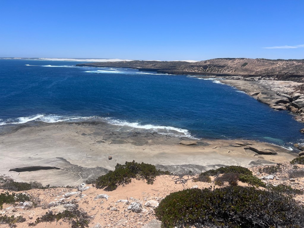
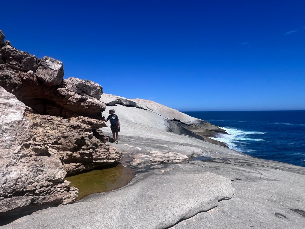
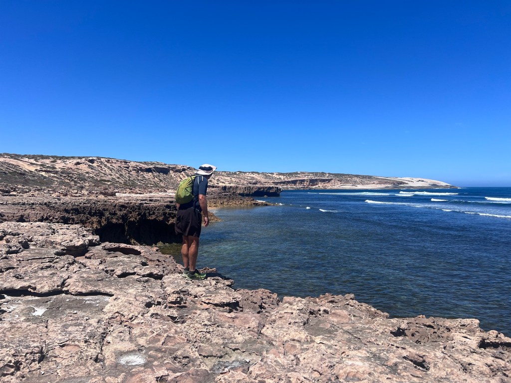
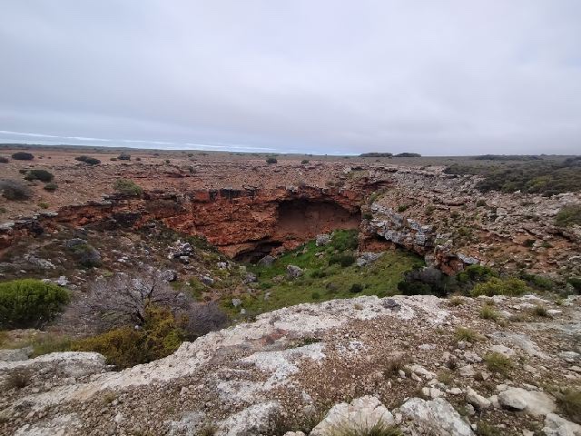
We continue to follow the Granite around the coastline until we can go no further due to the contour then head up and across the point til we find 4WD tracks which we follow, backtracking a few times until we reach the other side and Point Le Hunte.

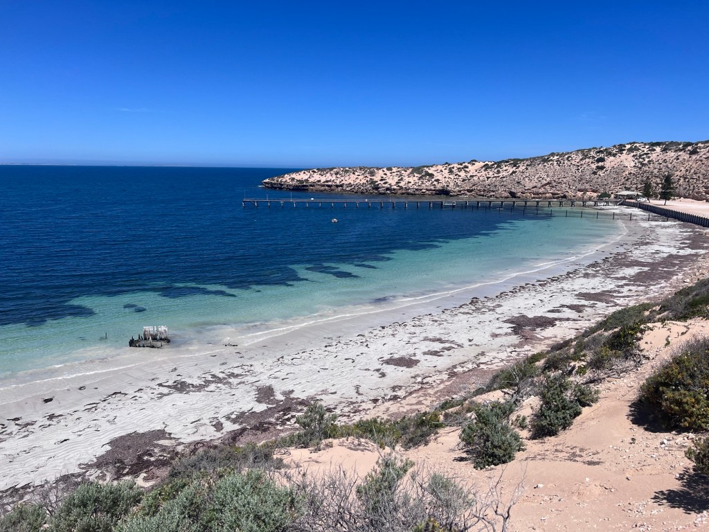
We head down and explore the jetty and read about the shipwreck and the jetty and a the tragic loss of a young boy to a shark attack in 1975 before we take a dip in the shark protected netted area.

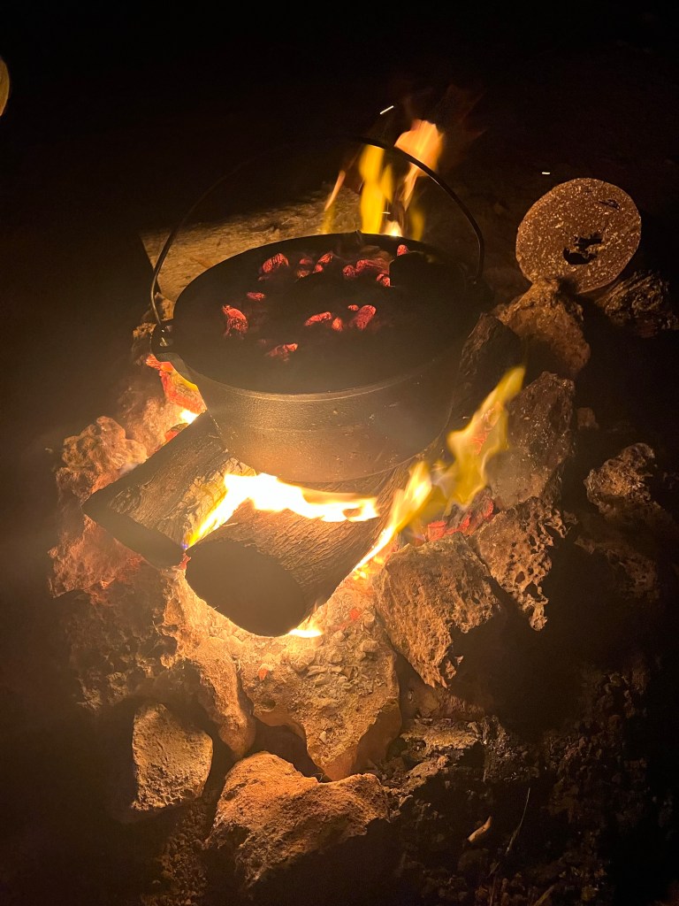
After our swim we walk back to camp along the dirt road admiring the huge sand dunes on either side of the point. We relax and once my bread has finished its 1st proof, I prepare for the bulk overnight proving in the fridge. Dinner is grilled fish and bean ragu.

This is such a lovely spot to relax and a credit to the original owner with such foresight to infrastructure in a remote outback area. Thank you. 🙏🏻

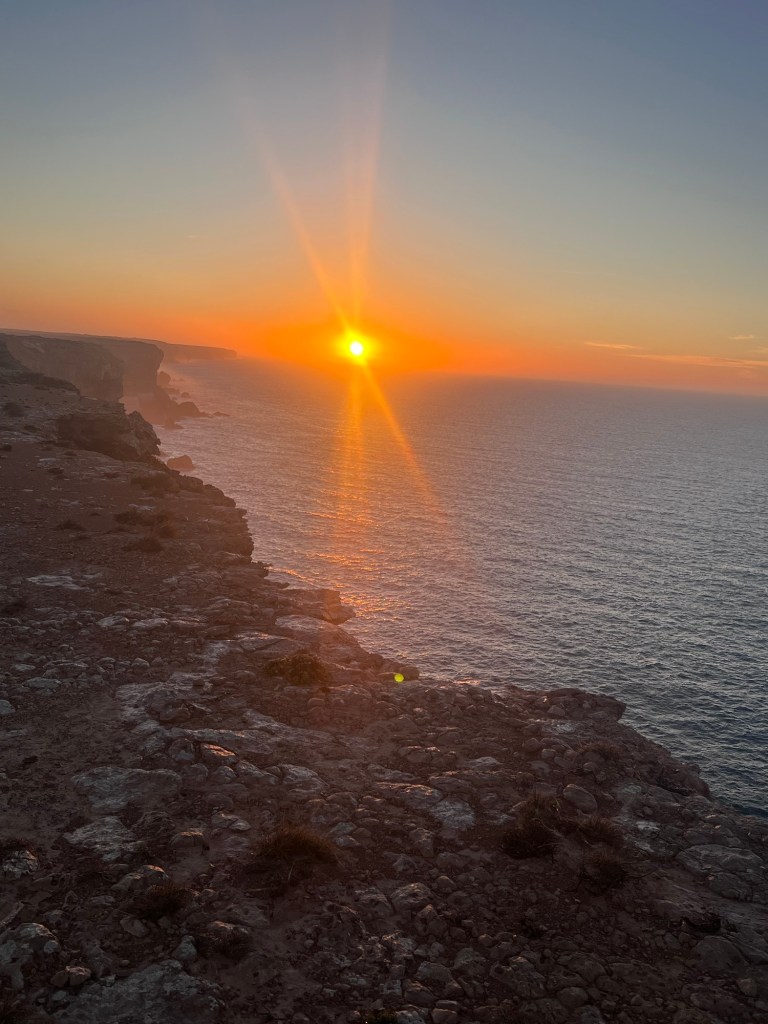
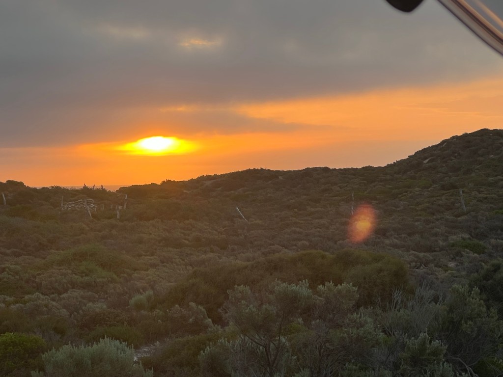
Our day is complete with another beautiful sunset. Complete with two surfers enjoying their last waves of the day.

Thursday 22 Feb, 16 – 28 degrees

We depart today, next stop Smoky Bay.

Love to all, stay safe, take care and be kind. xx

Aussie Lap – Kalgoorlie to Perth

Location: Norseman, Kalgoorlie, Southern Cross Perth.

Region: Goldfields – Esperance, wheatbelt

Dates: 17 – 19 August

Temperature: 7 – 20 Degrees

We leave Norseman early with a shortish drive to Kalgoorlie (187 km). Not long after we leave we pass Dundas Rocks, then Lake Cowan so we pause for photos. The scenery is peppered by water which we weren’t expecting and the Great Western woodland continues for miles. I found out that this woodland covers over 16,000,000 hectares, a region larger than England and Wales!

I’ve been looking forward to visiting Kalgoorlie – Boulder, two neighbouring towns that I’ve always thought of as frontier towns, both with rich histories steeped in the gold-rushes of Western Australia.

We chose to stay at the RV stop as we are only here one night. After unhitching we head for the town centre to stock up and have lunch somewhere. The day is warm and I look forward to the walk. We visit the information centre and pick up brochures on everything WA – so much to see and do in this large state!

Kalgoorlie is bustling and we decide to lunch at the Kalgoorlie Hotel, pictured below and very nice. Afterwards we walk Hannan Street admiring the early architecture and the towns obvious commitment to preserving many of the buildings.

“Patrick Hannan was a gold prospector whose lucrative discovery on 14 June 1983 set off a major gold rush. The resulting gold mine has been mined ever since and is renowned as “The Golden Mile”, the richest square mile in the world!” – ref: Wikipedia.

The modern open-cut mine is a vast, astonishing sight that we visited later in the day.

Late in the afternoon we visit Mt Charlotte Reservoir and lookout, with views over the area and then race to the 5:00pm blast at the Superpit!

I like Kalgoorlie’s vibrancy and wish we could stay longer to explore further but our next stop is Southern Cross then onward to Perth by Saturday to catch the next Matilda’s game with friends.

Southern Cross is another town with it’s history steeped in mining with the first major discovery of gold there in 1887. These days most of the workers in the surrounding mines are FIFO (fly in, fly out) so the town is much quieter than days gone by. Charming with historical pubs and an interesting museum.

“Its historic importance lies in the fact that in 1887 it became the first major gold discovery in the Eastern Goldfields and therefore, for a time, it was seen as the mother town of Coolgardie and the grandmother of Kalgoorlie.” Ref: AussieTowns.com.au

Another interesting snippet is in the name. “Southern Cross was reputedly named after the famous constellation which Thomas Risely and Mick Toomey, who discovered the gold which led to the settlement of the area, claimed had been led to their discovery. They named the goldfield Southern Cross and the name of the town followed.” Ref: AussieTowns.com.au

On the way into Southern Cross I received the news that my Great niece Clare had just given birth to her second child, a son named Darcy Allen Green so after we arrived and set down we went for a walk around the Main Street to find a pub to “wet the baby’s head”. Our first choice, The Palace was closed but The Club at the other end of the street was open. Congratulations Clare and Ryan on the safe arrival of Darcy.

Another fun fact about Souther Cross, most of the streets are named after constellations.

After our overnight at Southern Cross it’s onward to Perth. The drive continues through the Goldfields and into the Wheatbelt region that surrounds Perth. Soon we are met with stunning fields of Canola and Wheat.

We arrive safely in Perth just in time for the Matilda’s game against Sweden for third place. Sadly they lost the game but wow what effort. Well done Matilda’s

Aussie Lap – Nullabor

Location: Driving the Nullabor

Region: Flinders Rangers and Outback, Eyre Peninsula, Goldfields & Esperance

Dates: 13 August – 16 August 2023

Temperature: 6 – 18 degrees

It was a cool morning when we left Streaky Bay but we were very excited to be heading out into the Nullabor, one of Australia’s truely great drives.

Fun fact, Nullabor loosely translated from Latin means “ no trees”. Null = None or No and abor = trees.

We drive through Perlubie and Penong to Ceduna our first stop where we had planned to pay to fill the water tanks and get fuel (Rob had found a good price on Petrol Spy) but on arrival found the town in the middle of a planned electricity outage, so the water and fuel station we planned to visit were shut! Fortunately we found the BP was still open and very busy, running on a generator and we were able to get both fuel ($$$) and water (free). Interesting the problems that crop up as you travel and the best laid plans of mice and men and all that goes with it!

Our camp for tonight Sunday 13/8 and Monday 14/8 is on the cliffs of the Great Australian Bight and it’s also our first 4×4 camp, driving off road and over dunes to the cliffs.

After finding the exit which is often tricky with Wiki Camps; being just a dirt track off the highway and no signage, we carefully drive the bumpy track and tight corners and the hump of the dunes with no problems and make our camp. The view of the cliffs is amazing to say the least, the power of the waves against the 120+ metre cliffs, the colours, the Great Southern Ocean are all awe inspiring. It’s nice to have a two nights here to take it in and explore.

With our full day on the cliffs we plan a walk and later I’m going to bake bread. I had spent the previous day working the dough in the car as we drove, dutifully folding the dough every hour and it had proven slowly overnight in the fridge.

The day showed promise of being clear so we were hopeful of seeing some whales also. Our bush walk explored the cliffs and the incoming track, and we also hunted for wild flowers and the sink hole we had read about. Apparently there lots of sink holes all along the coastline.

To finish our day we set a hot fire to bake the bread, before cooking dinner in the camp oven, fennel and garlic sausages with roast veg. Unfortunately baking bread directly in the coals is too hot (lesson learned) but I was able to salvage most of the the loaf after removing part of the bottom crust.

Later in the day Rob saw a Petrel over the sea and I saw a Sea eagle near camp.

On Wednesday we left early and as we drove out saw hundreds of cobwebs covered in dew. It’s always surprising to find life in arid areas and by the amount of webs it’s obvious there are lots of spiders and insects.

The landscape continues to change and delight and we stop at every cliff and coast viewpoint enjoying the sights, stopping just outside Cocklebiddy to bush camp again. On Thursday we stop in to see the wedge tailed Eagles (thanks Kay 😍) Samantha and Bruce before heading off. I took a photo of the sign so you can read about them and how we must all take great care on the roads to prevent hitting them.

Our third day of driving on the Nullabor is to Norseman. I’ve heard a lot about this town from my brother law Jon Fry who worked there for a period and has told me about the stunning Great Western Woodlands nearby.

As we leave Cocklebiddy, Rob spies an Emu dad with three chicks (no photo) close to the road. They are very cute with their stripped feather camouflage and we are delighted by the sight.

This drive has the longest straight stretch of road in Aus 246.6km. The last few days we have had lots of radio traffic from pilots of oversized vehicles and we are very glad to have the UHF as without warning it may be difficult to move off the road in time, due to the sometimes high and steep shoulders.

On the way into Norseman we had a shower of rain which changed all the colours in the landscape. On arrival we camped at Norseman RV park, very good and now has toilets (open 8:00-4:00) and close to the dump point.

After setup we visited Lyn Webb’s “Gallery of Splendid Isolation” and said hello as Kay and Jon know him. His outback photography is breathtakingly beautiful and not to be missed.

Later we had dinner at the local hotel and watched the Matilda’s in the Semi Final and while we didn’t get a win it was great to see the team advance so far in the World Cup and to see such great National support. Well done Matilda’s!

All in all the Nullabor has been a great drive with lots to see and do. We think we might even do the golf links on the return journey.

Tomorrow we are off to Kalgoorlie.

Hope you are all safe and well. Be kind to each other. xx